Do you like Mekong Delta Vietnam and want to some Mekong Delta travel? This sprawling region of southern Vietnam has river scenery and local culture. If you’re new to the area, this guide provides you with a complete overview. We explain what it is, where it is, how much it costs, how to get there, and highlights to experience.
What Is The Mekong Delta? Basic Definition
So, what is Mekong Delta Vietnam exactly? In simple terms, it is a vast, pragmatory lowland delta. It is formed where the Mekong River flows into the sea in southwestern Vietnam. Consider it as the mouth of the sprawling Mekong River.
It encompasses 13 provinces and municipalities. It developed over years from rich silt laid down by the river. Through this process, very fertile land was created. Its Vietnamese name, Đồng bằng Sông Cửu Long, translates to “Nine Dragon River Delta.” This refers to the nine major river branches the Mekong once divided into here before it flows into the sea.
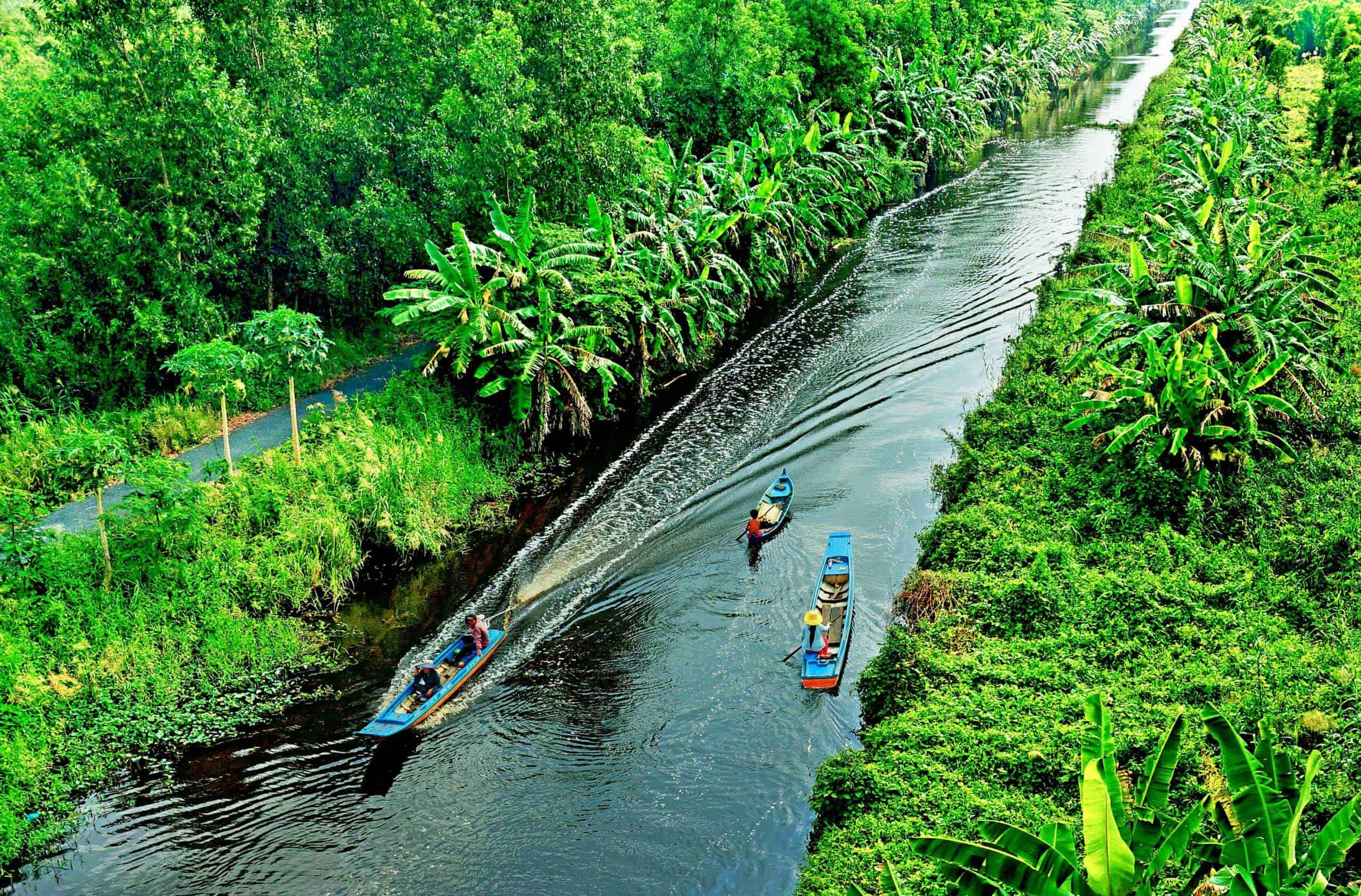
A labyrinth of rivers and canals crosses this whole area. The Mekong Delta Vietnam is characterized by this river network. It contours the flat landscape, and defines local life.
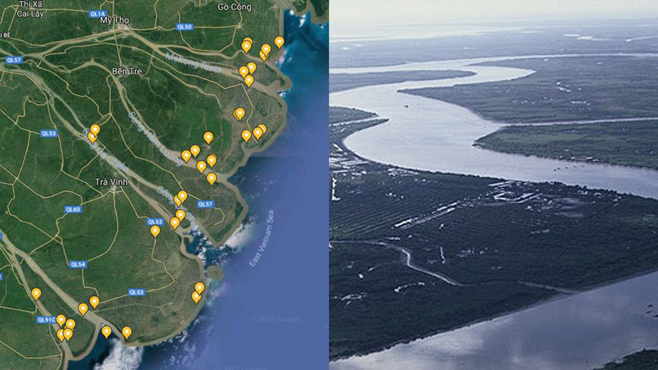
Where is the Mekong Delta?
Now, let’s locate Mekong Delta Vietnam on the map. So where is the Mekong Delta on the map?
You will see it located in the southernmost region of Vietnam. You can also call this region Southwestern Vietnam (Tây Nam Bộ). It’s a wide, triangular plain running down to the sea.
- Proximity to Ho Chi Minh City (HCMC): The region is directly southwest of HCMC (still often called Saigon). Its nearest major city in the Delta, My Tho, is a mere 70 kilometers (about 43 miles) away. This relative proximity makes the Delta easily reachable from HCMC. Ho Chi Minh City is a major landmark from where you can find Mekong Delta Vietnam.
- International and Coastal Borders: Secondly, it makes the answer to the question about where is the Mekong Delta clearer. The area has a land border with Cambodia to the north and northwest. It meets the sea over long coastlines: the East Sea (South China Sea) to the east and southeast, and the Gulf of Thailand to the southwest.
This geographical position is what distinguishes Mekong Delta Vietnam. It shaped the region’s climate, culture and economy.
Why is the Mekong Delta Important?
You may wonder, why is the mekong delta important? Importantly, its value to Vietnam is great, spanning multiple areas. Below is an overview of its key responsibilities:
- Economic Powerhouse (Agriculture & Aquaculture): It is the country’s most important agricultural land. It is often referred to as the “Rice Bowl,” and it produces more than 50% of the country’s rice. It is also one of the top producers of tropical fruits and seafood (especially farmed pangasius fish and shrimp). Such output has a large impact on the economy of Mekong Delta Vietnam and exports of the whole country.
- Also learning something from them, while learning from themselves, they supported the foundation on which food security for Vietnam depends highly on the large amount of food producers here. It plays a role in ensuring the country’s more than 100 million people have a reliable and affordable food supply, especially rice.
- Table of Contents: Ecological Significance: High levels of biodiversity Its wetlands and mangrove forests are home to countless fish, birds and other creatures. Such ecosystems help filter water, regulate floods, and protect coastlines, too. This unique ecology increases Mekong Delta Vietnam value.
- Clear Identity – River Utngari may have lasting cultural influences For many residents, daily life revolves around the waterways. Different ethnic groups such as Kinh (Viet), Khmer, Hoa, and Cham people live together in the area.
- Vital Hydrological System – Rivers and Canals: This aspect is crucial since a dense network of these redigests water. It is a source of water for agriculture and daily life. And it is a key transportation artery for the movement of goods and people around the region.
We summarize below a few of the main reasons the Mekong Delta is significant.
How to Get to the Mekong Delta
Not sure about your travel to Mekong Delta and how to get to Mekong Delta from Ho Chi Minh city (HCMC)? You have a few practical options. The vast majority of visitors begin their trip from HCMC. The most popular means of transportation to the Mekong Delta Vietnam is by bus.
Here’s a guide to the primary ways to get there:
- Bus / Coach (Xe Khách): It is the cheapest, regular and the highly used method for both locals and travelers.
- Companies: Plentiful operators ply the route, the dominant and best-known being FUTA Bus Lines (more popularly Phương Trang), which has an excellent service with simple online booking.
- Diane: Most leave from Mien Tay Bus Station (Western Bus Station) in HCMC.
- Destinations & Times (Approx. estimates from HCMC):
- My Tho: ~1.5 hours
- Ben Tre: ~2 hours
- Vinh Long: ~2.5 – 3 hours
- Can Tho: ~3 – 3.5 hours
- Vehicle Types: Mostly comfortable seater buses for shorter trips like My Tho/Ben Tre; sleeper buses are also offered for longer trips like Can Tho.
- Private Car / Taxi / Ride-Hailing: Whereas hiring a private car with driver, taking a taxi, or using ride-hailing apps (Grab is quite widespread) gives a much better level of comfort and flexibility. But this is still way more expensive than taking the bus.
- Motorbike: The best option for expert tourers with a Vietnamese driving license (or the right international driving permit) who are at ease with the bustling streets. Take a close look at the distances and your riding ability.
- By Airplane (Direct to Can Tho): To arrive in the heart of the Delta as fast as possible, you can go straight to Can Tho International Airport (VCA), especially if you are in North or Central Vietnam. It is connected by major domestic routes to Hanoi and Da Nang. Current schedules can be checked with: Vietnam Airlines, Vietjet Air Another route into Mekong Delta Vietnam comes by way of flying. You may also be able to fly internationally with limited availability.
- Organized Tour: There are many tour operators who run packages out of HCMC which includes a round-trip ride (by bus or van typically) and takes care of all travel logistics for you.
Consider these options according to your budget, desired comfort level, time availability, and overall Mekong Delta Vietnam travel plan.
Exploring the Mekong Delta: Key Experiences & Activities
What to see and do once you reach Mekong Delta Vietnam? There are multiple Mekong cruise and memorable Mekong experience travel available in the region. Life here revolves so much around the water and agriculture. This connection is reflected in most activities.
Here are some highlights to add to your itinerary:
- Go on several boat trips: The only way to get out on the water is to get out on the water, and it’s a must. Including excursions on larger motorized boats plying the main river channels, or more intimate jaunts on small wooden rowboats (sampans) paddled through narrow, sleepy canals lined with water coconut palms. Boat tours are crucial for navigating Mekong Delta Vietnam.
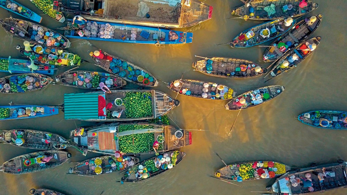
- Tour a Floating Market: Seeing a floating market in action offers insight into the traditional river-centric trade of the area. Cai Rang Floating Market in Can Tho ranks as the biggest and most well-known for wholesale agricultural goods. The best times to visit, for the liveliest atmosphere, are very early in the morning (between 5:00 AM to 7:00 AM at the latest)
- A staple activity when you mekong explore involves hopping onto one of the many fertile river islets, where common cultural experiences await.
- Walking through fruit orchards and sampling ripe, seasonal tropical fruits.
- The Đờn ca tài tử folk music performances.
- For visiting workshops to see how local products like coconut candy or rice paper are produced. These islets are popular destinations of Mekong Delta Vietnam tours.
- Main Delta Cities/Towns: In addition to the countryside, Berkeley or Sacramento might be worth a day or two:
- Can Tho: Stroll on the busy Ninh Kieu Quay waterfront, most colorful at night.
- My Tho / Ben Tre: Commonly seen in tandem as points of entry from HCMC, there are islands known as Tứ Linh and coconut workshops.
- Vinh Long: A good base for visiting An Binh Islet and neighboring pottery villages.
- Try a Homestay: For a closer experience of local life, an overnight at a homestay, especially on islets like An Binh, gives an opportunity to interact with host families and get a taste of local daily life.
- Cycling: Is biking through the rural landscapes, villages and orchards at death peacefully, well, just operate on a backroad or islet path, as it is easily accessible on the flat level of the road. You can rent bicycles in most areas.
- Eating: Be sure to set aside time to sample the regional cuisine. Seek out dishes – using plenty of freshwater fish (snakehead fish and elephant ear fish are two examples), river prawns, local vegetables and an exceptionally wide selection of tropical fruits.
These types of activities are typically at the heart of most Mekong Delta travel itineraries, providing interesting ways to experience the region’s unique environment and culture.
Tour Options and Mekong Travel Agency Choices
For many Mekong Delta Vietnam visitors first timers or those short on time joining an organized tour is frequently the easiest option.
- Common Types of Tour: There are several different options you will see available:
- Day Trips: Usually the trips start early from Ho Chi Minh City, activities happen in the easily-accessed My Tho and Ben Tre region (and visits to some islets such as Thoi Son and Phung) before returning to HCMC in the evening. They provide an easily digestible summary.
- Multi-Day Trips: Tours that take two, three or more days travel further into the Delta, to cities such as Can Tho (the floating market) or Chau Doc (bordering Cambodia). These typically include overnight accommodation (in hotels or homestays) as well as a greater variety of experiences.
- Using a Travel Agency: When seeking a Mekong Travel Agency, you’ll find both local and international providers, including Viet Kolors Tour and others, offering various package tours. You can find and book these tour online beforehand, or just find tour agent written out on paper from hotel and tour desk in HCMC or Can Tho when you arrive. The necessary logistics – transportation, boat arrangements, activity fees, specified meals (which may vary according to your preferences) and often an English-speaking guide – are typically handled by such agencies.
- Choosing Your Tour: It pays to compare various itineraries online. Check out precisely which sites are visited and which things to do are part and parcel of it. Peruse recent reviews from fellow travelers to get a sense of quality and pace. Pick the right tour for you for Mekong Delta Vietnam, your budget and your time.
While traveling independently has more flexibility, using organized tours adds significant convenience and eliminates potential headache for getting around the Delta.
Conclusion: Planning Your Mekong Delta Exploration
Before & Preparing your trip to Mekong Delta Vietnam The first step to plan your trip in Mekong Delta Vietnam is to realize its scope. This guide offered a glimpse of this vast, fruitful southern region. You read about its approximate location, its worth, ways to get there and what people typically do when visiting.
There are so many things to do in the Mekong Delta! You can plan and do quick day trips around Ho Chi Minh City for a first glance. Or you can schedule longer days for deeper immersion. You could opt for the structure of an organized tour or the freedom of independent travel. Depending on when you read this, use the information here as your starting point. Read more about specific towns, islets or experiences you might be most interested in. We hope this guide helps you plan your own gratifying experience during Mekong Delta Vietnam.
To experience the authentic river life and vibrant local culture firsthand, feel free to explore our curated Mekong Delta tour collection at Viet Kolors Tour. We are dedicated to providing immersive journeys that showcase the true essence and hidden gems of the Mekong region.