So if you’re wondering just where is the Mekong Delta, read on. This guide will cover a lot of ground with regard to all things geographical about this unique and significant part of Vietnam and where exactly it is on the map. To appreciate what it has to offer in terms of landscape, culture and importance, it helps to understand its location.
Position: South Vietnam
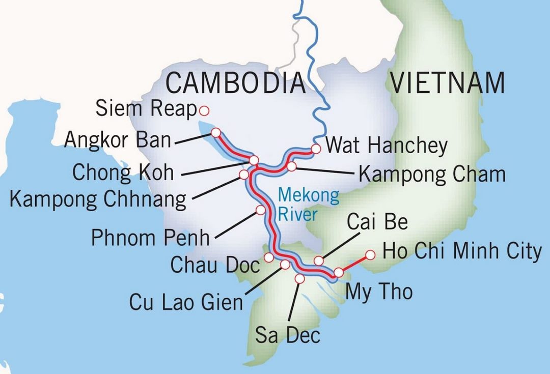
The Mekong Delta is the southernmost region of Vietnam. It is the large, flat, low-lying area where the large network of rivers that makes up the Mekong River system ends on the sea, after spreading out into many canals and channels before emptying into the East Sea (South China Sea), which is the most basic geographical answer to the question where is the Mekong Delta.
Key Location References
To find the Mekong Delta on the map, the proximity to surrounding major geographical features is a good reference point for orientation.
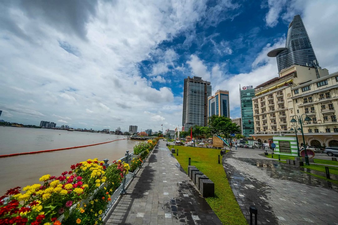
With Respect to Ho Chi Minh City (Saigon)
A key tenant of that context includes Vietnam’s largest metropolis, Ho Chi Minh City (HCMC), and even outdated Saigon, itself the primary urban touchpoint when asking where is the Mekong Delta. It is located directly to the southwest of HCMC.
The distance differs throughout the wide Delta:
- My Tho, a popular gateway in Tien Giang province, is around 70 kilometers (some 43 miles) from central HCMC.
- The Delta’s primary city, its capital, and regional center, Can Tho lies further southwest, some 170 kilometers (about 105 miles) away by road.
The average road travel times from HCMC to My Tho’s nearest sites are 1.5-2 hours, and from HCMC to central cities like Can Tho are 3-4 hours or more, depending on traffic conditions. These distances help give a real idea of where the Mekong Delta is in terms of travel accessibility from the main Vietnam international gateway.
Bordering Cambodia
On its northern and northwestern sides, the Mekong Delta area has a large international land frontier with Cambodia. Geographically, key provinces in the Mekong Delta region of Vietnam, namely An Giang, Dong Thap, Kien Giang, and Long An, make direct contact with Cambodian territory, helping demystify where is the Mekong Delta sits geopolitically.
Coastal Borders
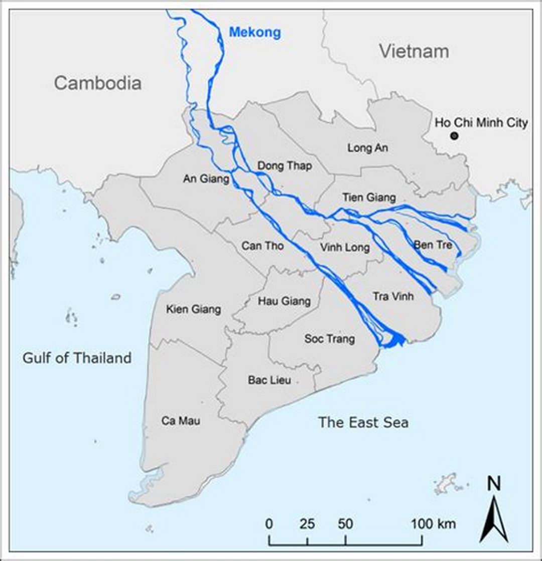
With its southern tip jutting out from Vietnam’s coastline, the Mekong Delta extends into two major bodies of water that set the maritime borders for where is the Mekong Delta ends:
- The region is bordered on the east and southeast by the East Sea (South China Sea / Biển Đông).
- Its southwest area is bordered by the Gulf of Thailand, including areas around the Ca Mau peninsula and Kien Giang province.
Provinces in the Mekong Delta
Beyond its general coordinates, enumerating the populating provinces can help map out where is the Mekong Delta administratively, and illuminate its vast extent.
An Area that Spans Several Provinces
To answer where is the Mekong Delta exactly, it also requires a solution on its internal structure. There are 13 centrally-administrated units in the Mekong Delta: 12 provinces (tỉnh) and 1 centrally-governed city (thành phố trực thuộc trung ương). Each contributes in its own way to the Delta’s character and geography:
- Can Tho City (Thành phố Cần Thơ): The important urban center and economic engine of the region, located on the shores of Hau River (Bassac River).
- An Giang Province: Known for the pilgrimage site of Sam Mountain near Chau Doc and significant floating communities, this province lies upstream along the Cambodian border.
- Bac Lieu Province: A coastal province near the southern tip of the Delta known for its offshore wind farms and historical architecture.
- Ben Tre Province: Nicknamed the ‘capital of coconuts’, this province consists primarily of fertile islets that branch out from the Tien River.
- The southernmost point of Vietnam, with rich mangrove forests (U Minh Ha National Park) and complex canal systems in Ca Mau Province.
- Dong Thap Province: Sharing a border with Cambodia on the north, known for its lotus fields, Tram Chim National Park (a top bird sanctuary) and the old town of Sa Dec.
- Hau Giang Province: An inland province, situated immediately south of Can Tho City, with a countryside of rice paddies and agricultural canals.
- Kien Giang Province: The biggest province in Vietnam by land area, boasting a long western coastline beside the Gulf of Thailand, a border with Cambodia and the Phu Quoc archipelago and many smaller islets.
- Long An Province: The entrance province on the northeast border of Ho Chi Minh City, has 2 characteristics of the Delta and the Southeast region.
- Soc Trang Province: This coastal province is known for its large Khmer population, colorful pagodas and for being the heart of Khmer culture in the Delta.
- Tien Giang Province: As the nearest gateway to the Delta from HCMC with My Tho city; along the main Tien River branch and many accessible fruit orchards.
- Tra Vinh Province: This province is sandwiched between the Tien and Hau rivers and has a coastline on the East Sea. It also has the highest concentration of Khmer people and pagodas.
- Vinh Long Province: Situated in the middle of the Delta between the two rivers (the Tien and Hậu), composed of rich, alluvial islands, ideal for growing fruits, traditional craft villages (brick kilns).
Familiarity with this provincial division gives a better sense of the Mekong Delta’s size, administrative structure and inner diversity.
Location Reflections: Where to Find the Mekong Delta
A quick rundown of the basic facts of where is the Mekong Delta:
- Region: Located in the Southernmost Vietnam.
- Lies: Ref Point: W-SW of HCMC (Ho Chi Minh City)
- Bordering Countries: Borders with Cambodia (North/Northwest), in addition to stands at East Sea / Gulf of Thailand.
- Proportion: It covers 13 provinces and cities.
Hope these few pointers clarify where is the Mekong Delta exactly for you.
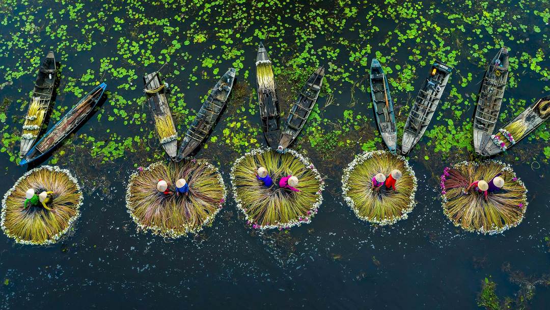
To experience the authentic river life and vibrant local culture firsthand, feel free to explore our curated Mekong Delta tour collection at Viet Kolors Tour. We are dedicated to providing immersive journeys that showcase the true essence and hidden gems of the Mekong region.